Cole (former) station, 1984
Introduction
The photograph on this page of Cole (former) station, 1984 by Ben Brooksbank as part of the Geograph project.
The Geograph project started in 2005 with the aim of publishing, organising and preserving representative images for every square kilometre of Great Britain, Ireland and the Isle of Man.

There are currently over 7.5m images from over 14,400 individuals and you can help contribute to the project by visiting https://www.geograph.org.uk
Cole (former) station, 1984
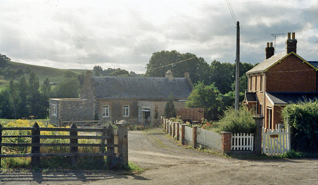
Image: © Ben Brooksbank Taken: 30 Aug 1984
View NW, across the course of the ex-Somerset & Dorset Joint Bath - Evercreech Junction (right) - Templecombe (left) - Bournemouth line. The station had closed on 7/3/66 along with the whole famous route. By 1984 it appears to have become a private house.
Images are licensed for reuse under creativecommons.org/licenses/by-sa/2.0
Image Location
Latitude
51.101018
Longitude
-2.472107