Chatham Station from the east
Introduction
The photograph on this page of Chatham Station from the east by Ben Brooksbank as part of the Geograph project.
The Geograph project started in 2005 with the aim of publishing, organising and preserving representative images for every square kilometre of Great Britain, Ireland and the Isle of Man.

There are currently over 7.5m images from over 14,400 individuals and you can help contribute to the project by visiting https://www.geograph.org.uk
Chatham Station from the east
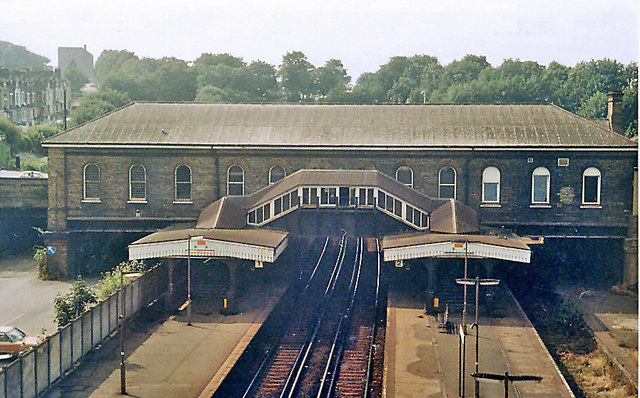
Image: © Ben Brooksbank Taken: 24 Jul 1983
This major station on the ex-London, Chatham & Dover (later SE&C) main line from London (Victoria, or Holborn Viaduct) to Ramsgate and Dover is situated between several tunnels. The view is westwards, towards Rochester and London. By 1983, rationalization had removed the Up Relief line.
Images are licensed for reuse under creativecommons.org/licenses/by-sa/2.0
Image Location
Latitude
51.38079
Longitude
0.519492