Livery Street looking northeast
Introduction
The photograph on this page of Livery Street looking northeast by Robin Stott as part of the Geograph project.
The Geograph project started in 2005 with the aim of publishing, organising and preserving representative images for every square kilometre of Great Britain, Ireland and the Isle of Man.

There are currently over 7.5m images from over 14,400 individuals and you can help contribute to the project by visiting https://www.geograph.org.uk
Livery Street looking northeast
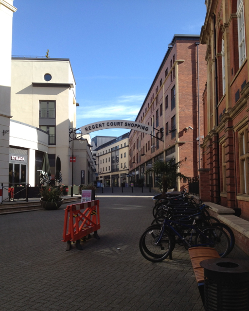
Image: © Robin Stott Taken: 6 Mar 2012
Livery Street sounds old but is a recent creation, a street of shops and cafés in the former backland of the Regent Hotel, Regent Street east and Regent Grove. This entry between the 1884 Town Hall, right, and the 1809 Regent Hotel, now a Travelodge, extreme left, originally led to the stables and coach houses to the rear of the hotel, hence the livery label. It evolved into a car park and garage. The shops have been bundled as Regent Court in an attempt to make them seem like somewhere. Livery Street is a handy traffic-free short cut between the Parade and Regent Street but, sadly, is often in shadow, lacks any character and feels dead.
Images are licensed for reuse under creativecommons.org/licenses/by-sa/2.0
Image Location


Leaflet Map data © OpenStreetMap
Latitude
52.289597
Longitude
-1.534471