"Bridge Hill" Dundee
Introduction
The photograph on this page of "Bridge Hill" Dundee by Douglas Nelson as part of the Geograph project.
The Geograph project started in 2005 with the aim of publishing, organising and preserving representative images for every square kilometre of Great Britain, Ireland and the Isle of Man.

There are currently over 7.5m images from over 14,400 individuals and you can help contribute to the project by visiting https://www.geograph.org.uk
"Bridge Hill" Dundee
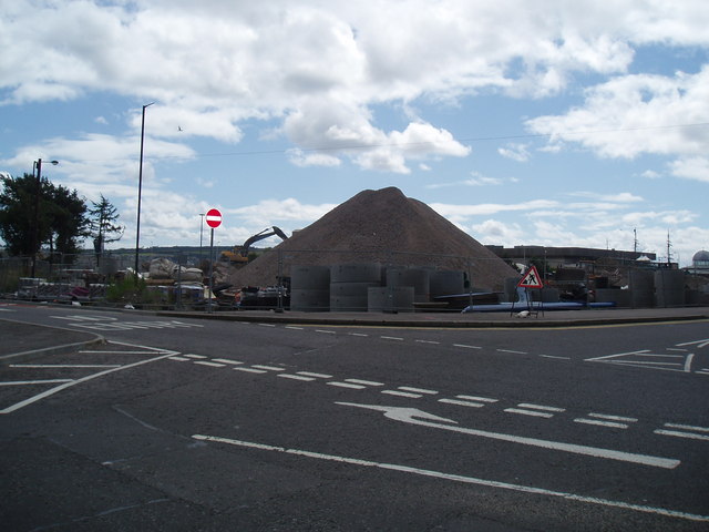
Image: © Douglas Nelson Taken: 27 Jul 2012
As part of the redevelopment of the City Centre, ramps at the Tay Road Bridge have been realigned. As a consequence this hill has appeared from the rubble.
Images are licensed for reuse under creativecommons.org/licenses/by-sa/2.0
Image Location
Latitude
56.460454
Longitude
-2.965659