St Helen's Church, Hangleton
Introduction
The photograph on this page of St Helen's Church, Hangleton by Paul Gillett as part of the Geograph project.
The Geograph project started in 2005 with the aim of publishing, organising and preserving representative images for every square kilometre of Great Britain, Ireland and the Isle of Man.

There are currently over 7.5m images from over 14,400 individuals and you can help contribute to the project by visiting https://www.geograph.org.uk
St Helen's Church, Hangleton
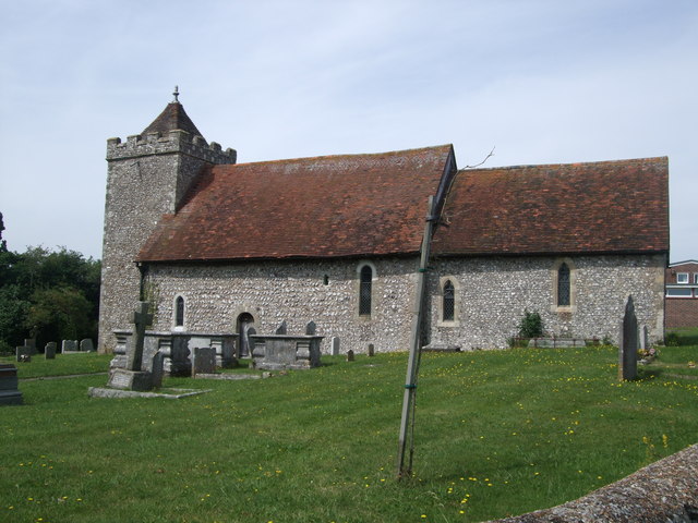
Image: © Paul Gillett Taken: 11 Aug 2012
The church stood between the manor house and the cottages and houses of Hangleton village to the northeast, and was a rectangular building 62 feet (19m) long and 17.5 feet (5m), with flint walls 3.5 feet (1 m) thick. Rebuilding began in the 12th century. The nave dates from that century, while the square tower was added in the 13th century and the church was re-roofed at that time (having originally been thatched). The 12th-century chancel was rebuilt in around 1300. Website: http://www.hangletonparish.com/
Images are licensed for reuse under creativecommons.org/licenses/by-sa/2.0
Image Location
Latitude
50.850828
Longitude
-0.200792