Grade II listed former railway bridge, Pontllanfraith
Introduction
The photograph on this page of Grade II listed former railway bridge, Pontllanfraith by Jaggery as part of the Geograph project.
The Geograph project started in 2005 with the aim of publishing, organising and preserving representative images for every square kilometre of Great Britain, Ireland and the Isle of Man.

There are currently over 7.5m images from over 14,400 individuals and you can help contribute to the project by visiting https://www.geograph.org.uk
Grade II listed former railway bridge, Pontllanfraith
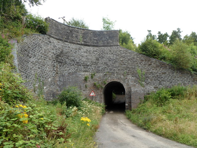
Image: © Jaggery Taken: 8 Aug 2012
I was unaware of this bridge's existence, but was tempted to explore the lane named Tir-philkins by a sign on the main road showing 180 yards to a 6' 3" headroom bridge. The height of the roof at the midpoint is about 8 feet, but the 6' 3" clearance takes account of the width of a vehicle. The bridge was built in the early 1800s to convey a horse-drawn tramway (for carrying coal) over the road. The stonework was later extended when the tramway was converted to a railway. The outline of the original smaller structure can be seen below the extension. The railway line closed in 1989. The bridge was grade II listed in March 1999.
Images are licensed for reuse under creativecommons.org/licenses/by-sa/2.0
Image Location
Latitude
51.663104
Longitude
-3.184067