Stepney Street (Recreated)
Introduction
The photograph on this page of Stepney Street (Recreated) by Hywel Williams as part of the Geograph project.
The Geograph project started in 2005 with the aim of publishing, organising and preserving representative images for every square kilometre of Great Britain, Ireland and the Isle of Man.

There are currently over 7.5m images from over 14,400 individuals and you can help contribute to the project by visiting https://www.geograph.org.uk
Stepney Street (Recreated)
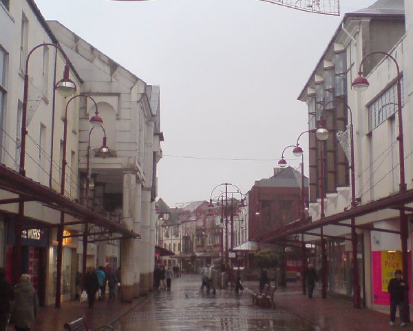
Image: © Hywel Williams Taken: 8 Jan 2007
This is a recreation of the following 1965 photo from the Frith collection: http://www.francisfrith.com/search/wales/dyfed/llanelli/photos/llanelli_L73095.htm Unlike the western end of Stepney Street Image which has remained largely unchanged over the last 100 years, the story is very different for the eastern end. The buildings on the right hand side appear to all be post 1965 with even the 1950s/1960s Boots building having been demolished and rebuilt recently. The entire road is now pedestrianised and the road junction to the left has been covered and turned into the Elli Centre shopping precinct.
Images are licensed for reuse under creativecommons.org/licenses/by-sa/2.0
Image Location
Latitude
51.68156
Longitude
-4.160947