The Red House
Introduction
The photograph on this page of The Red House by Alan Murray-Rust as part of the Geograph project.
The Geograph project started in 2005 with the aim of publishing, organising and preserving representative images for every square kilometre of Great Britain, Ireland and the Isle of Man.

There are currently over 7.5m images from over 14,400 individuals and you can help contribute to the project by visiting https://www.geograph.org.uk
The Red House
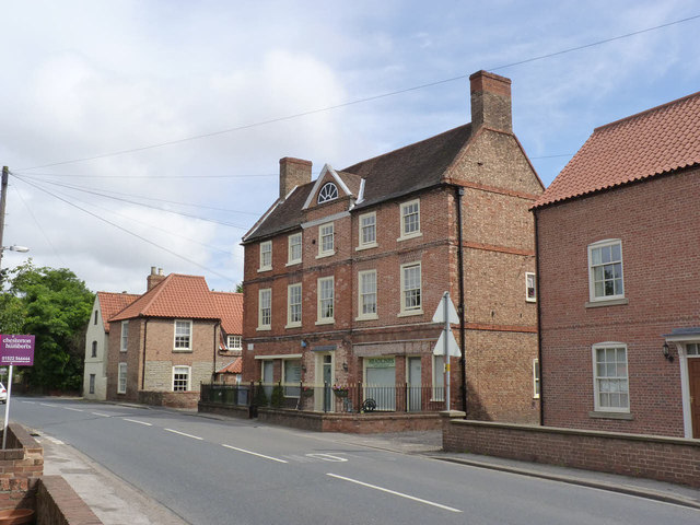
Image: © Alan Murray-Rust Taken: 5 Aug 2012
A large mid-18th century house, later converted to include 3 shops. Compare with http://www.geograph.org.uk/photo/937415 - the window surrounds have been painted in a more traditional colour, and the front door has been rebuilt to nearer its original pattern. Interestingly, the local Conservation Area appraisal has encouraged the retention of redundant shop fronts to emphasise the historic importance of retail trades in this thriving village, so it will be interesting to see whether further changes occur. Listed grade II.
Images are licensed for reuse under creativecommons.org/licenses/by-sa/2.0
Image Location
Latitude
53.143475
Longitude
-0.760877