The Ballysillan Road, Belfast (1)
Introduction
The photograph on this page of The Ballysillan Road, Belfast (1) by Albert Bridge as part of the Geograph project.
The Geograph project started in 2005 with the aim of publishing, organising and preserving representative images for every square kilometre of Great Britain, Ireland and the Isle of Man.

There are currently over 7.5m images from over 14,400 individuals and you can help contribute to the project by visiting https://www.geograph.org.uk
The Ballysillan Road, Belfast (1)
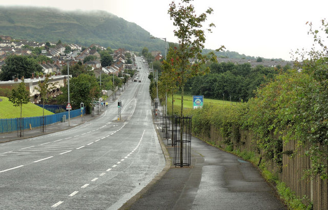
Image: © Albert Bridge Taken: 5 Aug 2012
The Ballysillan Road runs from the Crumlin Road (behind me) to the Old Cavehill Road. The road (but not all the houses and streets) seems to have been built towards the end of the 19th century. This view, at just under 300ft, is from opposite the Bilston Road. The entrance to the leisure centre is marked by the blue sign at middle right. For a similar view in August 2009 see Image See also Image
Images are licensed for reuse under creativecommons.org/licenses/by-sa/2.0
Image Location
Latitude
54.623091
Longitude
-5.971501