Snodland station from the footbridge
Introduction
The photograph on this page of Snodland station from the footbridge by Marathon as part of the Geograph project.
The Geograph project started in 2005 with the aim of publishing, organising and preserving representative images for every square kilometre of Great Britain, Ireland and the Isle of Man.

There are currently over 7.5m images from over 14,400 individuals and you can help contribute to the project by visiting https://www.geograph.org.uk
Snodland station from the footbridge
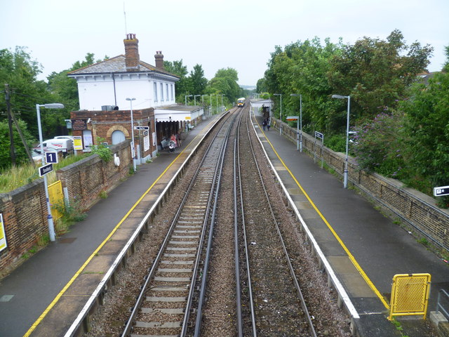
Image: © Marathon Taken: 1 Aug 2012
The Medway Valley Line was built in two stages by the South Eastern Railway. The first stage opened in 1844 was from Paddock Wood following the Medway Valley to Maidstone. In 1856 the line was extended down the Medway Valley to the North Kent Line at Strood (which had opened in 1847). Snodland station opened like the rest of the line on 18th June 1856. The original station building on the northbound platform was closed in the 1990s and became an Indian restaurant. This view of the station from the footbridge sees a northbound train on its way to Strood.
Images are licensed for reuse under creativecommons.org/licenses/by-sa/2.0
Image Location


Leaflet Map data © OpenStreetMap
Latitude
51.330229
Longitude
0.448241