Former Queen Mary Street school
Introduction
The photograph on this page of Former Queen Mary Street school by Thomas Nugent as part of the Geograph project.
The Geograph project started in 2005 with the aim of publishing, organising and preserving representative images for every square kilometre of Great Britain, Ireland and the Isle of Man.

There are currently over 7.5m images from over 14,400 individuals and you can help contribute to the project by visiting https://www.geograph.org.uk
Former Queen Mary Street school
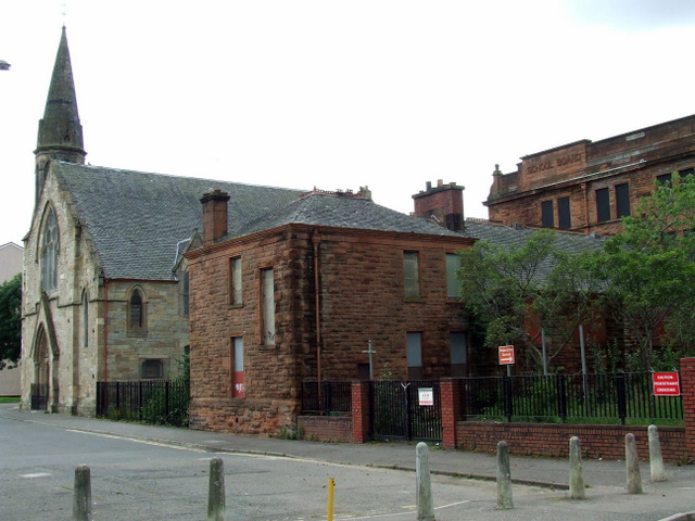
Image: © Thomas Nugent Taken: 14 Jul 2012
The Janitor's house on the Queen Mary Street side of the building. The church is St Francis In The East Church of Scotland.
Images are licensed for reuse under creativecommons.org/licenses/by-sa/2.0
Image Location
Latitude
55.848522
Longitude
-4.219513