1
Bridge 50 (Union Bridge) Monmouth and Brecon Canal
This bridge is where the Griffithstown to New Inn road crosses the canal and is believed to be named after a long since demolished workhouse.
Image: © nantcoly
Taken: 24 Dec 2005
0.01 miles
2
Exit from County Hospital, Pontypool
Viewed from Bridge Street. The road exits from the hospital into Coedygric Road.
Image: © Jaggery
Taken: 21 Jan 2011
0.01 miles
3
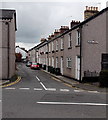
Northern section of Bridge Street, Griffithstown, Pontypool
Looking towards the junction with Coedygric Road. In the background is the SE edge of County Hospital. http://www.geograph.org.uk/photo/2246096
Image: © Jaggery
Taken: 21 Jan 2011
0.01 miles
4
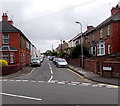
Broad Street, Griffithstown, Pontypool
Looking south from the Coedygric Road end.
Image: © Jaggery
Taken: 9 Aug 2014
0.04 miles
5
Northern end of Bridge Street, Griffithstown, Pontypool
Looking south across Coedygric Road.
Image: © Jaggery
Taken: 9 Aug 2014
0.05 miles
6
Weak bridge, Coedygric Road, Pontypool
There is a 7.5 tonnes weight limit across the bridge over the Monmouthshire & Brecon Canal.
County Hospital is on the right.
Image: © Jaggery
Taken: 9 Aug 2014
0.05 miles
7
Picton Street, Griffithstown, Pontypool
Viewed across Coedygric Road looking south towards High Street.
Image: © Jaggery
Taken: 9 Aug 2014
0.05 miles
8
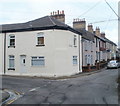
Corner of High Street and Bridge Street, Griffithstown, Pontypool
Viewed from the northern edge of Commercial Street. Ahead for Bridge Street, left for High Street.
Image: © Jaggery
Taken: 21 Jan 2011
0.06 miles
9
Monmouthshire & Brecon Canal: Bridge 50 (Griffithstown)
Image: © Gareth James
Taken: 23 Oct 2011
0.06 miles
10
Union Bridge [no 50] from the north
Carrying Coedygric Road over the Mon & Brec canal.
Image: © Christine Johnstone
Taken: 15 Sep 2013
0.06 miles


![Union Bridge [no 50] from the north](https://s0.geograph.org.uk/geophotos/03/66/79/3667980_e9ce375d_120x120.jpg)