Milborne Port: London Road
Introduction
The photograph on this page of Milborne Port: London Road by Martin Bodman as part of the Geograph project.
The Geograph project started in 2005 with the aim of publishing, organising and preserving representative images for every square kilometre of Great Britain, Ireland and the Isle of Man.

There are currently over 7.5m images from over 14,400 individuals and you can help contribute to the project by visiting https://www.geograph.org.uk
Milborne Port: London Road
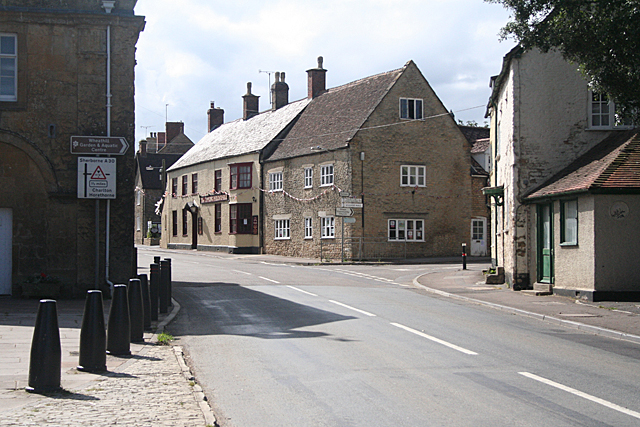
Image: © Martin Bodman Taken: 28 Jul 2012
The North Street turning is on the right. The Tippling Philosopher inn is further down London Road, on the right. The eighteenth-century Town Hall is in shadow on the left. It dates from the days when Milborne Port was a 'rotten borough' like Ilchester, before the Reform Act of 1832
Images are licensed for reuse under creativecommons.org/licenses/by-sa/2.0
Image Location
Latitude
50.966358
Longitude
-2.461199