Hunters Farm: dated gable
Introduction
The photograph on this page of Hunters Farm: dated gable by John Sutton as part of the Geograph project.
The Geograph project started in 2005 with the aim of publishing, organising and preserving representative images for every square kilometre of Great Britain, Ireland and the Isle of Man.

There are currently over 7.5m images from over 14,400 individuals and you can help contribute to the project by visiting https://www.geograph.org.uk
Hunters Farm: dated gable
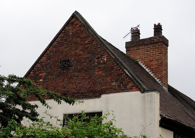
Image: © John Sutton Taken: 19 Jul 2012
The gable end is dated 1724 in a slightly darker brick. The farmhouse had its origins in the previous century and is Grade II listed - see http://www.britishlistedbuildings.co.uk/en-457483-hunters-farm-31-and-33-nottingham for the full story.
Images are licensed for reuse under creativecommons.org/licenses/by-sa/2.0
Image Location
Latitude
52.927081
Longitude
-1.160386