A hand down the alley
Introduction
The photograph on this page of A hand down the alley by David Lally as part of the Geograph project.
The Geograph project started in 2005 with the aim of publishing, organising and preserving representative images for every square kilometre of Great Britain, Ireland and the Isle of Man.

There are currently over 7.5m images from over 14,400 individuals and you can help contribute to the project by visiting https://www.geograph.org.uk
A hand down the alley
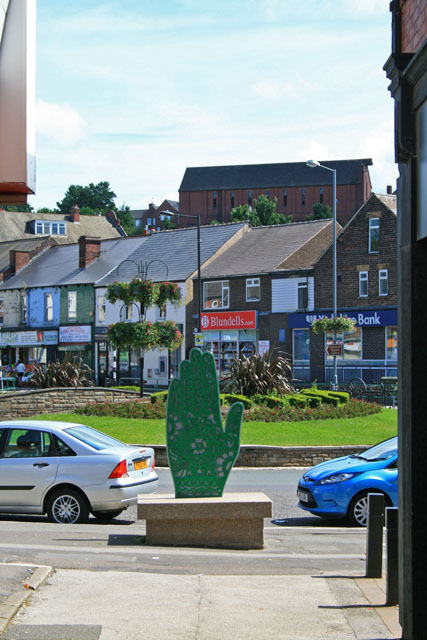
Image: © David Lally Taken: 15 Jul 2012
A curious artwork beside the Firth Park roundabout. Taken from the alley between said roundabout and West Quadrant. On the skyline the stark outline of St Hilda's church http://www.geograph.org.uk/photo/1645503 slowly decays.
Images are licensed for reuse under creativecommons.org/licenses/by-sa/2.0
Image Location
Latitude
53.418011
Longitude
-1.448248