Sherwell or Sherril
Introduction
The photograph on this page of Sherwell or Sherril by Derek Harper as part of the Geograph project.
The Geograph project started in 2005 with the aim of publishing, organising and preserving representative images for every square kilometre of Great Britain, Ireland and the Isle of Man.

There are currently over 7.5m images from over 14,400 individuals and you can help contribute to the project by visiting https://www.geograph.org.uk
Sherwell or Sherril
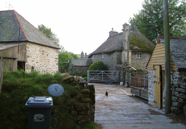
Image: © Derek Harper Taken: 13 Jun 2006
Mapped as both, listed as the former. The thatched farmhouse is described at http://www.britishlistedbuildings.co.uk/en-441399-sherwell-farmhouse-widecombe-in-the-moor . Both it and the barn on the left, shown in Image, are former longhouses.
Images are licensed for reuse under creativecommons.org/licenses/by-sa/2.0
Image Location
Latitude
50.558971
Longitude
-3.866466