Site of Coulsdon North station
Introduction
The photograph on this page of Site of Coulsdon North station by Marathon as part of the Geograph project.
The Geograph project started in 2005 with the aim of publishing, organising and preserving representative images for every square kilometre of Great Britain, Ireland and the Isle of Man.

There are currently over 7.5m images from over 14,400 individuals and you can help contribute to the project by visiting https://www.geograph.org.uk
Site of Coulsdon North station
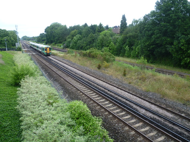
Image: © Marathon Taken: 18 Jul 2012
In this view from the footbridge near Coulsdon Town station, the fast lines are nearer the camera and the slow lines are beyond. Coulsdon North station was located here, straddling all four tracks. It was opened as 'Stoats Nest and Cane Hill' in 1899 and went through several different names before being closed as Coulsdon North in 1983. It is only a very short walk to Smitham (now Coulsdon Town) station (see http://www.geograph.ie/photo/3045242 ) and this was one of the reasons it was closed. More information about Coulsdon North station can be found at http://en.wikipedia.org/wiki/Coulsdon_North_railway_station and http://www.disused-stations.org.uk/c/coulsdon_north/index.shtml
Images are licensed for reuse under creativecommons.org/licenses/by-sa/2.0
Image Location
Latitude
51.321598
Longitude
-0.132631