Howden-le-Wear: back lane of School Street
Introduction
The photograph on this page of Howden-le-Wear: back lane of School Street by Trevor Littlewood as part of the Geograph project.
The Geograph project started in 2005 with the aim of publishing, organising and preserving representative images for every square kilometre of Great Britain, Ireland and the Isle of Man.

There are currently over 7.5m images from over 14,400 individuals and you can help contribute to the project by visiting https://www.geograph.org.uk
Howden-le-Wear: back lane of School Street
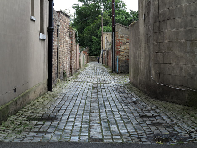
Image: © Trevor Littlewood Taken: 19 Jul 2012
The back lane is a feature of terraced housing throughout the UK. Houses of School Street are certainly to the right in the image and possibly to the left as well. The building immediately to the left is an unusually named public house: 'The Australian'.
Images are licensed for reuse under creativecommons.org/licenses/by-sa/2.0
Image Location
Latitude
54.695021
Longitude
-1.751111