Arnold, NG5 (St Mary's)
Introduction
The photograph on this page of Arnold, NG5 (St Mary's) by David Hallam-Jones as part of the Geograph project.
The Geograph project started in 2005 with the aim of publishing, organising and preserving representative images for every square kilometre of Great Britain, Ireland and the Isle of Man.

There are currently over 7.5m images from over 14,400 individuals and you can help contribute to the project by visiting https://www.geograph.org.uk
Arnold, NG5 (St Mary's)
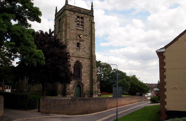
Image: © David Hallam-Jones Taken: 12 Jul 2012
The tower of St Mary's Anglican Church, a Grade II-listed building, is seen here on the other side of Church Lane from Allen's Walk. It seems likely that Allen's Walk was named after the Allens, a family associated with the parish from 1820 onwards. Some of their graves can be seen in the graveyard. A church was constructed here in 1270 when the family of Arnehall, or Arnold were prominent in the area. As an example, Ralph de Arnehall was created a knight by Edward I in 1278. The chancel has been dated to the fourteenth century when the Earls of Hereford were in possession of the property.
Images are licensed for reuse under creativecommons.org/licenses/by-sa/2.0
Image Location
Latitude
53.009455
Longitude
-1.127192