The River Irwell at Radcliffe
Introduction
The photograph on this page of The River Irwell at Radcliffe by Bill Boaden as part of the Geograph project.
The Geograph project started in 2005 with the aim of publishing, organising and preserving representative images for every square kilometre of Great Britain, Ireland and the Isle of Man.

There are currently over 7.5m images from over 14,400 individuals and you can help contribute to the project by visiting https://www.geograph.org.uk
The River Irwell at Radcliffe
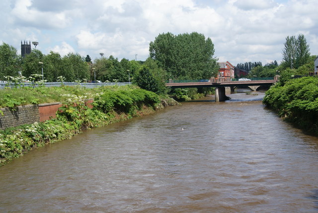
Image: © Bill Boaden Taken: 7 Jul 2012
The level is still quite full following recent unseasonal rain, but not as high as it was a couple of weeks ago. The nearest bridge carries Pilkington Way which is a mini bypass for the town. The tower of St Thomas's Church is to the left.
Images are licensed for reuse under creativecommons.org/licenses/by-sa/2.0
Image Location
Latitude
53.556748
Longitude
-2.326322