Botriphnie Primary School
Introduction
The photograph on this page of Botriphnie Primary School by Anne Burgess as part of the Geograph project.
The Geograph project started in 2005 with the aim of publishing, organising and preserving representative images for every square kilometre of Great Britain, Ireland and the Isle of Man.

There are currently over 7.5m images from over 14,400 individuals and you can help contribute to the project by visiting https://www.geograph.org.uk
Botriphnie Primary School
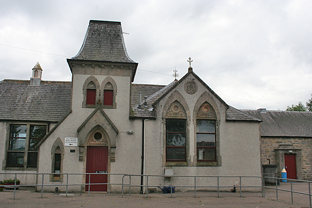
Image: © Anne Burgess Taken: 6 Jul 2012
The building dates from 1875, according to the roundel above the windows. It has a rather elaborate façade with curiously shaped windows and stone carvings, and I keep wondering if the tower was intended to be a spire.
Images are licensed for reuse under creativecommons.org/licenses/by-sa/2.0
Image Location
Latitude
57.483597
Longitude
-3.036041