Hillfoot End and Shillington from the air
Introduction
The photograph on this page of Hillfoot End and Shillington from the air by M J Richardson as part of the Geograph project.
The Geograph project started in 2005 with the aim of publishing, organising and preserving representative images for every square kilometre of Great Britain, Ireland and the Isle of Man.

There are currently over 7.5m images from over 14,400 individuals and you can help contribute to the project by visiting https://www.geograph.org.uk
Hillfoot End and Shillington from the air
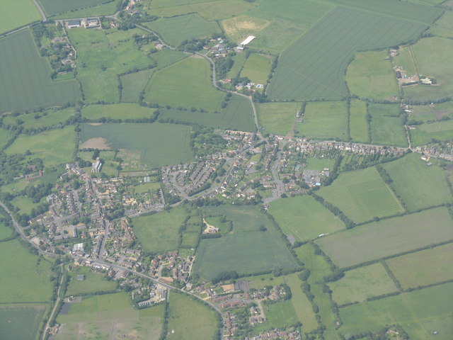
Image: © M J Richardson Taken: 28 Jun 2012
All Saints Church is to the left, and the roads in the centre are at Hillfoot End. Hanscombe End Road heads upwards out of the picture.
Images are licensed for reuse under creativecommons.org/licenses/by-sa/2.0
Image Location
Latitude
51.995827
Longitude
-0.36763