Pub sign: 'The Tide End Cottage', Teddington Lock
Introduction
The photograph on this page of Pub sign: 'The Tide End Cottage', Teddington Lock by Stefan Czapski as part of the Geograph project.
The Geograph project started in 2005 with the aim of publishing, organising and preserving representative images for every square kilometre of Great Britain, Ireland and the Isle of Man.

There are currently over 7.5m images from over 14,400 individuals and you can help contribute to the project by visiting https://www.geograph.org.uk
Pub sign: 'The Tide End Cottage', Teddington Lock
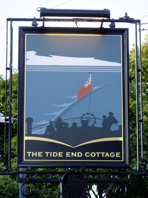
Image: © Stefan Czapski Taken: 30 Jun 2012
Being out in the weather, pub signs get repainted from time to time. If you're fond of an existing sign, the chances are the new one will be a disappointment. This sign brings the language of pub signs up to date, and I'd say it does so very effectively. The picture shows the evacuation of the British Expeditionary Force from Dunkirk in 1940 (and commemorates Teddington's own 'little ships'). But if you don't at first 'get' the historical background, the image is still a striking one: soldiers in their tin hats at the stern of the ship, the Red Ensign, the ship's wake, the sea and sky - and that's all, no wasted detail that can't be seen from street level. The pub gets its name from its location - close to the highest point to which tides flow on the Thames. Update, October 2014: could it be that the artist had a certain well-known paddle-steamer in mind when painting this sign? : Image
Images are licensed for reuse under creativecommons.org/licenses/by-sa/2.0
Image Location
Latitude
51.429511
Longitude
-0.323014