Through the Bric-a-Brac to Eaton Grove
Introduction
The photograph on this page of Through the Bric-a-Brac to Eaton Grove by Simon Carey as part of the Geograph project.
The Geograph project started in 2005 with the aim of publishing, organising and preserving representative images for every square kilometre of Great Britain, Ireland and the Isle of Man.

There are currently over 7.5m images from over 14,400 individuals and you can help contribute to the project by visiting https://www.geograph.org.uk
Through the Bric-a-Brac to Eaton Grove
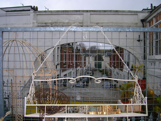
Image: © Simon Carey Taken: 30 Dec 2006
The bric-a-brac belongs to The Conservatory whose shop is just in view to the right. Behind the metal fence is the arch through to Eaton Grove a mews like area of housing which was constructed in the 1880s. The houses have garages below with living accommodation above.
Images are licensed for reuse under creativecommons.org/licenses/by-sa/2.0
Image Location
Latitude
50.833744
Longitude
-0.168075