Looking west from Bridge Road, Sutton
Introduction
The photograph on this page of Looking west from Bridge Road, Sutton by Marathon as part of the Geograph project.
The Geograph project started in 2005 with the aim of publishing, organising and preserving representative images for every square kilometre of Great Britain, Ireland and the Isle of Man.

There are currently over 7.5m images from over 14,400 individuals and you can help contribute to the project by visiting https://www.geograph.org.uk
Looking west from Bridge Road, Sutton
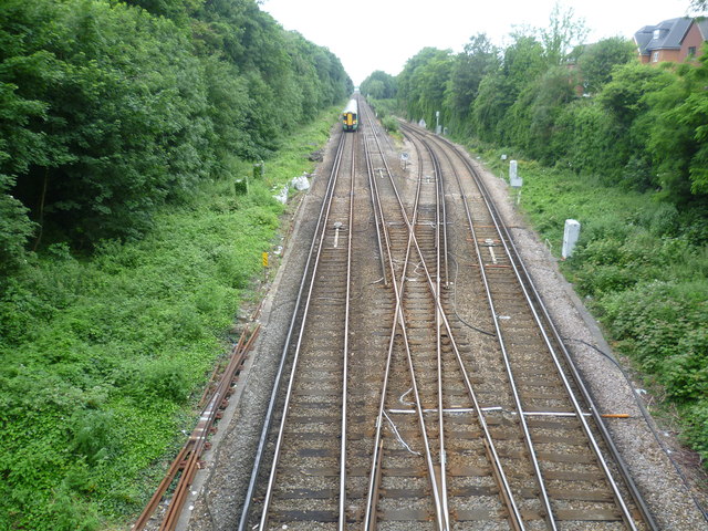
Image: © Marathon Taken: 27 Jun 2012
This is just west of Sutton station and is seen from Bridge Road. The left hand pair of lines lead to Cheam and were opened in 1847. The right hand lines belong to the Wimbledon to Sutton line. This was first proposed in the early 1880s with the intention of stimulating house building across the clay pastures between the two towns, which up until then had remained largely untouched. It can be seen going into a steep-sided, narrow cutting. As the area was fully built-up by the time of the line's construction, the chalk cutting had to be lined in places with concrete to reinforce its steep sides and so minimise the land take. The Wimbledon to Sutton line was designed for electric trains, with many inclines and sharp curves, although it hardly justified the drivers' nickname for it: "Wall of Death".
Images are licensed for reuse under creativecommons.org/licenses/by-sa/2.0
Image Location
Latitude
51.358837
Longitude
-0.196327