Darbyshire Street
Introduction
The photograph on this page of Darbyshire Street by David Dixon as part of the Geograph project.
The Geograph project started in 2005 with the aim of publishing, organising and preserving representative images for every square kilometre of Great Britain, Ireland and the Isle of Man.

There are currently over 7.5m images from over 14,400 individuals and you can help contribute to the project by visiting https://www.geograph.org.uk
Darbyshire Street
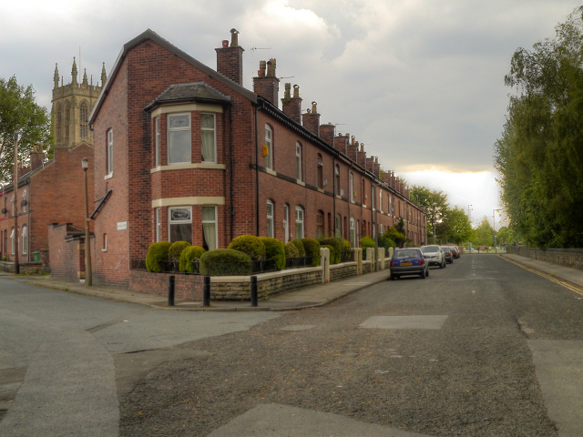
Image: © David Dixon Taken: 20 Jun 2012
Terraced houses on Darbyshire Street. These appear to have been built in the late eighteenth or early nineteenth century as the street does not appear on the OS map of 1893 https://bit.ly/2XS1D78 but is shown on the map dated 1909 https://bit.ly/3nZ9gDF. The land on the other side of the wall on the right-hand side was previously the course of the Lancashire and Yorkshire Railway's Clifton, Accrington and Colne line. See Image] for a view from the other end of the street.
Images are licensed for reuse under creativecommons.org/licenses/by-sa/2.0
Image Location
Latitude
53.561961
Longitude
-2.326211