View of Uckfield in 1967
Introduction
The photograph on this page of View of Uckfield in 1967 by John Baker as part of the Geograph project.
The Geograph project started in 2005 with the aim of publishing, organising and preserving representative images for every square kilometre of Great Britain, Ireland and the Isle of Man.

There are currently over 7.5m images from over 14,400 individuals and you can help contribute to the project by visiting https://www.geograph.org.uk
View of Uckfield in 1967
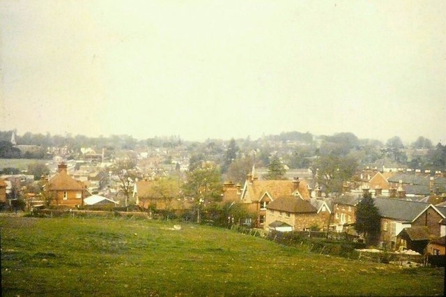
Image: © John Baker Taken: 30 Apr 1967
As seen from Victoria Pleasure Ground. A similar view can be found in the Francis Frith collection http://www.francisfrith.com/uckfield/photos/view-from-victoria-pleasure-ground-c1950_u1004/ but the modern day view has been obscured by a housing estate, with some houses being built along the northern boundary of the ground. On the left of the frame, the steeple of Holy Cross church, in Church Street, can be seen.
Images are licensed for reuse under creativecommons.org/licenses/by-sa/2.0
Image Location
Latitude
50.966375
Longitude
0.095206