Thorn
Introduction
The photograph on this page of Thorn by Derek Harper as part of the Geograph project.
The Geograph project started in 2005 with the aim of publishing, organising and preserving representative images for every square kilometre of Great Britain, Ireland and the Isle of Man.

There are currently over 7.5m images from over 14,400 individuals and you can help contribute to the project by visiting https://www.geograph.org.uk
Thorn
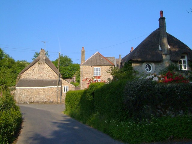
Image: © Derek Harper Taken: 8 Jun 2006
A pretty hamlet, also shown in Image The farmhouse on the left has C16 origins http://list.english-heritage.org.uk/resultsingle.aspx?uid=1146736&searchtype=mapsearch ; Thorn Cottage on the right is described at http://list.english-heritage.org.uk/resultsingle.aspx?uid=1106202&searchtype=mapsearch . The cottage in the centre, with a pair of 16-pane sash windows, is described at http://list.english-heritage.org.uk/resultsingle.aspx?uid=1309126&searchtype=mapsearch ; its Victorian post box is just hidden by the hedge.
Images are licensed for reuse under creativecommons.org/licenses/by-sa/2.0
Image Location
Latitude
50.664081
Longitude
-3.862566