Nottingham - NG2 (W. Bridgford)
Introduction
The photograph on this page of Nottingham - NG2 (W. Bridgford) by David Hallam-Jones as part of the Geograph project.
The Geograph project started in 2005 with the aim of publishing, organising and preserving representative images for every square kilometre of Great Britain, Ireland and the Isle of Man.

There are currently over 7.5m images from over 14,400 individuals and you can help contribute to the project by visiting https://www.geograph.org.uk
Nottingham - NG2 (W. Bridgford)
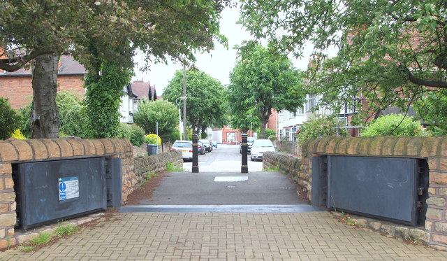
Image: © David Hallam-Jones Taken: 9 Jun 2012
A pair of manually-operated metal flood gates and a "humped" footpath connecting the embankment path (behind the photographer) with Balmoral Avenue. This arrangement forms part of secondary anti-flooding measures for this residential area. Examples of these arrangements can also be seen in neighbouring Sandringham Avenue.
Images are licensed for reuse under creativecommons.org/licenses/by-sa/2.0
Image Location
Latitude
52.933753
Longitude
-1.138089