Crumlin Viaduct from A467 road bridge at Low Level station
Introduction
The photograph on this page of Crumlin Viaduct from A467 road bridge at Low Level station by Ben Brooksbank as part of the Geograph project.
The Geograph project started in 2005 with the aim of publishing, organising and preserving representative images for every square kilometre of Great Britain, Ireland and the Isle of Man.

There are currently over 7.5m images from over 14,400 individuals and you can help contribute to the project by visiting https://www.geograph.org.uk
Crumlin Viaduct from A467 road bridge at Low Level station
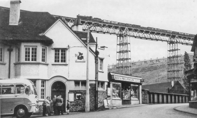
Image: © Ben Brooksbank Taken: 11 May 1957
View northward, towards Crumlin (High Level), Aberdare and Neath left, Pontypool Road right: ex-GWR Pontypool Road - Neath line. (Underneath is the Newport - Ebbw Vale/Brynmawr (Western Valleys) line; see Image The westbound empties 'perilously' high up on the 200-foot viaduct (demolished 1967), are headed by a 28XX 2-8-0 exemplifying the heavy coal traffic between the Welsh Valleys and England by this route, which however was closed on 15/06/1964.
Images are licensed for reuse under creativecommons.org/licenses/by-sa/2.0
Image Location
Latitude
51.679009
Longitude
-3.139645