Pedestal on Pollards Hill
Introduction
The photograph on this page of Pedestal on Pollards Hill by Marathon as part of the Geograph project.
The Geograph project started in 2005 with the aim of publishing, organising and preserving representative images for every square kilometre of Great Britain, Ireland and the Isle of Man.

There are currently over 7.5m images from over 14,400 individuals and you can help contribute to the project by visiting https://www.geograph.org.uk
Pedestal on Pollards Hill
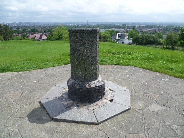
Image: © Marathon Taken: 6 Jun 2012
Pollards Hill occupies the highest point in Norbury and on a clear day the view stretches to Windsor Castle. It was originally part of the Great North Wood and the name 'Pollard' derives from this connection. The road layout of Pollards Hill was shown on maps of 1868 with two avenues of trees. Pollards Hill had been left as an open space as the surrounding estate developed and it was given to Croydon Council in 1913 by Sir Frederick Ederidge. The pedestal seen here was erected on the summit of the hill to show the direction of various local landmarks but the direction pointer on the top has disappeared. A trig point is close by. The view takes in the twin chimneys of the former Waddon Marsh Power Station, now next to IKEA. Croydon town centre is to the left.
Images are licensed for reuse under creativecommons.org/licenses/by-sa/2.0
Image Location
Latitude
51.403077
Longitude
-0.127301