Burial place of Buchanan of Auchentorlie
Introduction
The photograph on this page of Burial place of Buchanan of Auchentorlie by Lairich Rig as part of the Geograph project.
The Geograph project started in 2005 with the aim of publishing, organising and preserving representative images for every square kilometre of Great Britain, Ireland and the Isle of Man.

There are currently over 7.5m images from over 14,400 individuals and you can help contribute to the project by visiting https://www.geograph.org.uk
Burial place of Buchanan of Auchentorlie
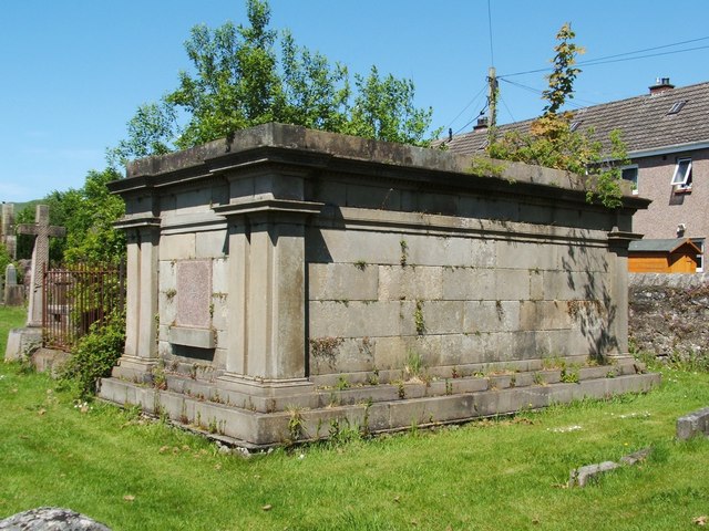
Image: © Lairich Rig Taken: 26 May 2012
This family vault is located to the ENE of Image According to the inscription on the marble tablet visible at the SW end of vault, "this tomb was restored in 1887". The tablet also bears the dates 1600 and 1887, a crest with motto "Clarior Hinc Honos" ("henceforth the honour [shall grow ever] brighter"), and the text "in memory of the Buchanans of Auchentorlie laid here since the year 1600". John Bruce gives a detailed account of the Auchentorlie and Dunnerbuck lands and their occupants, including a discussion of the Buchanans, on pages 202-215 of his "History of the Parish of West or Old Kilpatrick" (1893). The present-day Auchentorlie House is in Image; see also Image
Images are licensed for reuse under creativecommons.org/licenses/by-sa/2.0
Image Location
Latitude
55.926178
Longitude
-4.460389