Kenwick Park hotel and equestrian centre, aerial
Introduction
The photograph on this page of Kenwick Park hotel and equestrian centre, aerial by Chris as part of the Geograph project.
The Geograph project started in 2005 with the aim of publishing, organising and preserving representative images for every square kilometre of Great Britain, Ireland and the Isle of Man.

There are currently over 7.5m images from over 14,400 individuals and you can help contribute to the project by visiting https://www.geograph.org.uk
Kenwick Park hotel and equestrian centre, aerial
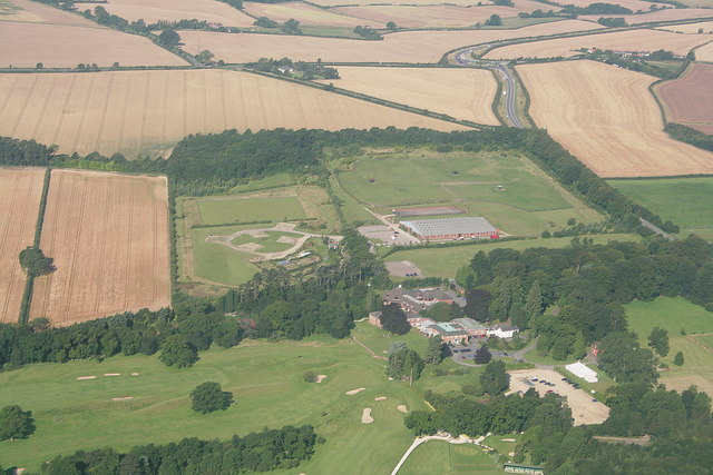
Image: © Chris Taken: 5 Aug 2007
Another picture of Kenwick Park, this time from the east, with the hotel and start of the golf course in the foreground. The large rectangular building above is the indoor riding arena of the Louth Rural Activities Centre. Above it is the outdoor arena ('manege'). The footpath mentioned in a previous aerial shot tracks along between the double tree line in the bottom left quarter.
Images are licensed for reuse under creativecommons.org/licenses/by-sa/2.0
Image Location


Leaflet Map data © OpenStreetMap
Latitude
53.343491
Longitude
0.016575