Coppiced area with standards
Introduction
The photograph on this page of Coppiced area with standards by Roger Jones as part of the Geograph project.
The Geograph project started in 2005 with the aim of publishing, organising and preserving representative images for every square kilometre of Great Britain, Ireland and the Isle of Man.

There are currently over 7.5m images from over 14,400 individuals and you can help contribute to the project by visiting https://www.geograph.org.uk
Coppiced area with standards
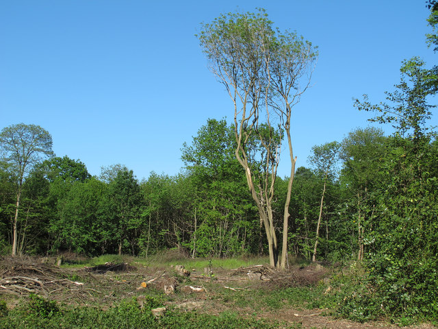
Image: © Roger Jones Taken: 27 May 2012
In the foreground you can see the coppice stools (stumps left to regrow) along with a couple of standards (trees left to grow naturally). Most of the trees here are sweet chestnut.
Images are licensed for reuse under creativecommons.org/licenses/by-sa/2.0
Image Location
Latitude
51.636707
Longitude
0.440291