Notts - NG16 (Underwood)
Introduction
The photograph on this page of Notts - NG16 (Underwood) by David Hallam-Jones as part of the Geograph project.
The Geograph project started in 2005 with the aim of publishing, organising and preserving representative images for every square kilometre of Great Britain, Ireland and the Isle of Man.

There are currently over 7.5m images from over 14,400 individuals and you can help contribute to the project by visiting https://www.geograph.org.uk
Notts - NG16 (Underwood)
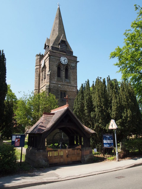
Image: © David Hallam-Jones Taken: 26 May 2012
St Michael and All Angels' Anglican Church is located at the Alfreton Road end of Church Lane, a stone's throw away from the Underwood Miners' Welfare Club premises. Mounted as a memorial immediately inside the lych gate is the pithead winding wheel from the Pye Hill (No.1) Colliery, installed here in 1985.
Images are licensed for reuse under creativecommons.org/licenses/by-sa/2.0
Image Location
Latitude
53.052185
Longitude
-1.294464