Footpath Extinguishment
Introduction
The photograph on this page of Footpath Extinguishment by Keith Evans as part of the Geograph project.
The Geograph project started in 2005 with the aim of publishing, organising and preserving representative images for every square kilometre of Great Britain, Ireland and the Isle of Man.

There are currently over 7.5m images from over 14,400 individuals and you can help contribute to the project by visiting https://www.geograph.org.uk
Footpath Extinguishment
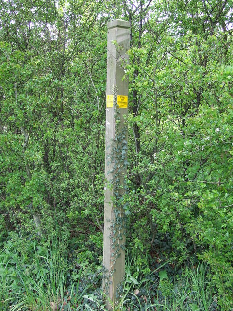
Image: © Keith Evans Taken: 17 May 2012
This footpath sign without a footpath finger indicates that the path is now closed. Suffolk county council have closed it and pinned the yellow notice on saying official path extinguishment. This post appears to be closer to the road than the one photographed by Bob Jones http://www.geograph.org.uk/photo/189228 when it was still open in 2006.
Images are licensed for reuse under creativecommons.org/licenses/by-sa/2.0
Image Location
Latitude
52.206876
Longitude
0.511818