Gunnery Terrace
Introduction
The photograph on this page of Gunnery Terrace by Robin Stott as part of the Geograph project.
The Geograph project started in 2005 with the aim of publishing, organising and preserving representative images for every square kilometre of Great Britain, Ireland and the Isle of Man.

There are currently over 7.5m images from over 14,400 individuals and you can help contribute to the project by visiting https://www.geograph.org.uk
Gunnery Terrace
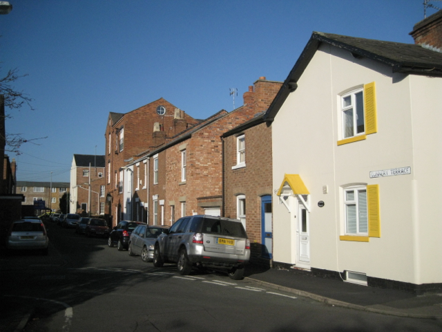
Image: © Robin Stott Taken: 15 Jan 2012
A short residential street seen here from the bend of Cross Road. In the distance, left, is the 20th-century 3-storey terrace of Cornwall Place, known to many as Rugby Road shops. The name Gunnery recalls Gunnery Farm on the Guy's Cliffe estate, long built over. The huge map of the 1805 Milverton inclosure award (which preceded any development) names it as Conery Farm.
Images are licensed for reuse under creativecommons.org/licenses/by-sa/2.0
Image Location
Latitude
52.291719
Longitude
-1.548377