Nottingham - NG1 (Hounds Gate)
Introduction
The photograph on this page of Nottingham - NG1 (Hounds Gate) by David Hallam-Jones as part of the Geograph project.
The Geograph project started in 2005 with the aim of publishing, organising and preserving representative images for every square kilometre of Great Britain, Ireland and the Isle of Man.

There are currently over 7.5m images from over 14,400 individuals and you can help contribute to the project by visiting https://www.geograph.org.uk
Nottingham - NG1 (Hounds Gate)
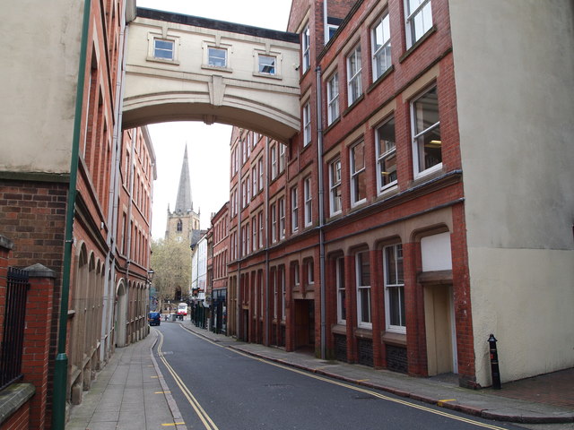
Image: © David Hallam-Jones Taken: 18 May 2012
The present day narrowness of Hounds Gate (or Hungate as it was previously known), seen here with St Peter’s Gate and St Peter’s Church in the distance, gives observers some idea of what the street might have looked like in medieval times. Indeed the closeness of the buildings at one point must have made it relatively easy to construct the overhead weatherproof interconnecting corridor with its “Bridge of Sighs” appearance. The bridge itself, connecting the two portions of a former soft-goods warehouse, was constructed in 1923.
Images are licensed for reuse under creativecommons.org/licenses/by-sa/2.0
Image Location
Latitude
52.951819
Longitude
-1.150084