Coombe Keynes
Introduction
The photograph on this page of Coombe Keynes by John Lamper as part of the Geograph project.
The Geograph project started in 2005 with the aim of publishing, organising and preserving representative images for every square kilometre of Great Britain, Ireland and the Isle of Man.

There are currently over 7.5m images from over 14,400 individuals and you can help contribute to the project by visiting https://www.geograph.org.uk
Coombe Keynes
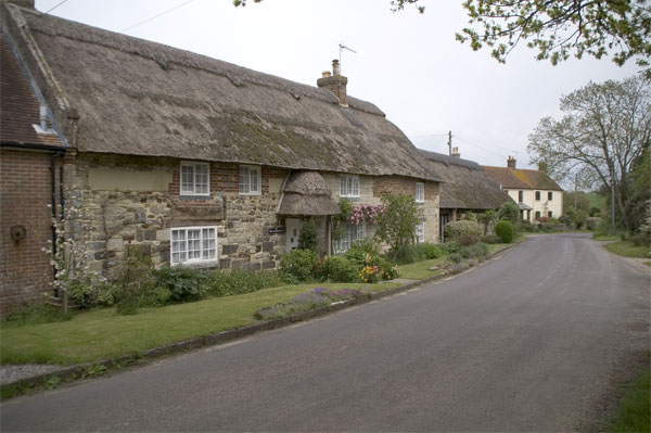
Image: © John Lamper Taken: 9 May 2006
The village has a lot of ‘picture postcard’ thatched cottages. This one is on the north side of the road leading to East Lulworth.
Images are licensed for reuse under creativecommons.org/licenses/by-sa/2.0
Image Location
Latitude
50.657612
Longitude
-2.223921