2012 : North east Devizes from Roundway Hill
Introduction
The photograph on this page of 2012 : North east Devizes from Roundway Hill by Maurice Pullin as part of the Geograph project.
The Geograph project started in 2005 with the aim of publishing, organising and preserving representative images for every square kilometre of Great Britain, Ireland and the Isle of Man.

There are currently over 7.5m images from over 14,400 individuals and you can help contribute to the project by visiting https://www.geograph.org.uk
2012 : North east Devizes from Roundway Hill
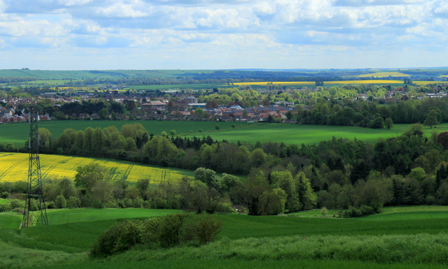
Image: © Maurice Pullin Taken: 11 May 2012
Looking along the Vale of Pewsey, the predominant crops here are oilseed rape and wheat with some barley. A bit of Devizes stretches across the frame, and that pylon at the bottom that looks as if it is leaning to the left is not (I've checked).
Images are licensed for reuse under creativecommons.org/licenses/by-sa/2.0
Image Location
Latitude
51.369568
Longitude
-1.974812