West Bridgford Community Hall and Bridgford Road
Introduction
The photograph on this page of West Bridgford Community Hall and Bridgford Road by John Sutton as part of the Geograph project.
The Geograph project started in 2005 with the aim of publishing, organising and preserving representative images for every square kilometre of Great Britain, Ireland and the Isle of Man.

There are currently over 7.5m images from over 14,400 individuals and you can help contribute to the project by visiting https://www.geograph.org.uk
West Bridgford Community Hall and Bridgford Road
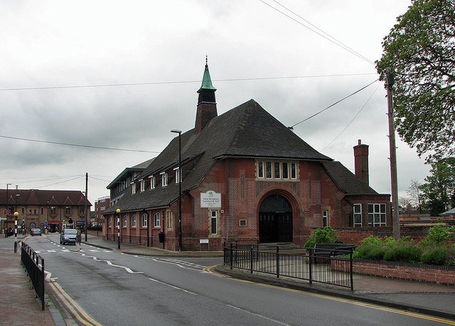
Image: © John Sutton Taken: 9 May 2012
The Parish Rooms date from the 1920s and are very much of the period. Kate Jewell's Image] shows the building from a different angle and on a brighter day.
Images are licensed for reuse under creativecommons.org/licenses/by-sa/2.0
Image Location
Latitude
52.931521
Longitude
-1.127868