Rilla Mill Chapel
Introduction
The photograph on this page of Rilla Mill Chapel by Eric Foster as part of the Geograph project.
The Geograph project started in 2005 with the aim of publishing, organising and preserving representative images for every square kilometre of Great Britain, Ireland and the Isle of Man.

There are currently over 7.5m images from over 14,400 individuals and you can help contribute to the project by visiting https://www.geograph.org.uk
Rilla Mill Chapel
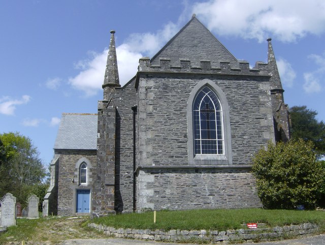
Image: © Eric Foster Taken: 12 May 2012
This former Methodist Chapel in the village of Rilla Mill has ceased acting as a place of worship, and is currently for sale. It is a 19th century building, constructed of granite with a slate roof. As Methodist Chapels go, it is an imposing building for a relatively small village and gives some indication of the support it must have had in the past when it was constructed. A splendid line of very old Yew trees adorns its north east boundary. A cemetery is located on the south west side of the chapel.
Images are licensed for reuse under creativecommons.org/licenses/by-sa/2.0
Image Location
Latitude
50.534884
Longitude
-4.404737