Lift bridge Somerset Coal Canal
Introduction
The photograph on this page of Lift bridge Somerset Coal Canal by Jo and Steve Turner as part of the Geograph project.
The Geograph project started in 2005 with the aim of publishing, organising and preserving representative images for every square kilometre of Great Britain, Ireland and the Isle of Man.

There are currently over 7.5m images from over 14,400 individuals and you can help contribute to the project by visiting https://www.geograph.org.uk
Lift bridge Somerset Coal Canal
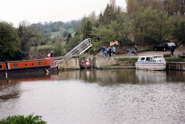
Image: © Jo and Steve Turner Taken: 30 Apr 1989
Entry and exit from the Brassknocker Basin to the Kennet and Avon canal by Dundas Aqueduct. In 1985 restoration began on the first quarter mile section of the 10 mile Somerset Coal Canal to Paulton that was opened in 1801 and closed in 1898. Mr. Hedley Smith and Mr. Tim Wheeldon formed the new Somerset Coal Canal Company and acquired the land and dug out and relined the old canal bed. The stop lock in the now private lockkeeper's cottage garden only had a rise of 7" so didn't need reinstating. The short tunnel under the A36/Warminster road was excavated and turned into a dry dock.
Images are licensed for reuse under creativecommons.org/licenses/by-sa/2.0
Image Location
Latitude
51.361394
Longitude
-2.311951