Roadside Stone on Staveley Lane
Introduction
The photograph on this page of Roadside Stone on Staveley Lane by Jonathan Clitheroe as part of the Geograph project.
The Geograph project started in 2005 with the aim of publishing, organising and preserving representative images for every square kilometre of Great Britain, Ireland and the Isle of Man.

There are currently over 7.5m images from over 14,400 individuals and you can help contribute to the project by visiting https://www.geograph.org.uk
Roadside Stone on Staveley Lane
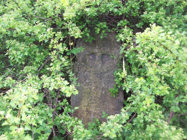
Image: © Jonathan Clitheroe Taken: 10 May 2012
Next to the road near Barrow Hill and enveloped by hedgerow is this intriguing stone which I presume is the monument referred to on the 1:25,000 map. It appears to have a round-headed cross design but in the middle of a heavy shower and with rush hour traffic whooshing past this wasn't the time to loiter. Any further information about this artefact would be most welcome though.
Images are licensed for reuse under creativecommons.org/licenses/by-sa/2.0
Image Location
Latitude
53.278864
Longitude
-1.369925