Llandogo
Introduction
The photograph on this page of Llandogo by Richard Webb as part of the Geograph project.
The Geograph project started in 2005 with the aim of publishing, organising and preserving representative images for every square kilometre of Great Britain, Ireland and the Isle of Man.

There are currently over 7.5m images from over 14,400 individuals and you can help contribute to the project by visiting https://www.geograph.org.uk
Llandogo
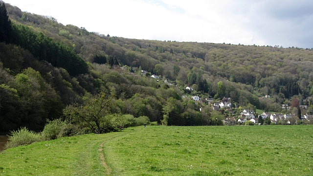
Image: © Richard Webb Taken: 6 May 2012
A view from the Wye with woodlands extending to a plateau just under 300m above. Cuckoo Wood shown here connects with a conifer plantation which extends as far as Trellech.
Images are licensed for reuse under creativecommons.org/licenses/by-sa/2.0
Image Location
Latitude
51.727054
Longitude
-2.684052