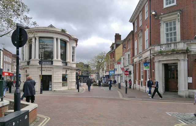
Ashford High Street
Introduction
The photograph on this page of Ashford High Street by Chris Morgan as part of the Geograph project.
The Geograph project started in 2005 with the aim of publishing, organising and preserving representative images for every square kilometre of Great Britain, Ireland and the Isle of Man.
There are currently over 7.5m images from over 14,400 individuals and you can help contribute to the project by visiting https://www.geograph.org.uk

Image: © Chris Morgan Taken: 9 May 2012
Looking closely at the Lloyds TSB building, at maximum resolution, you might be able to pick out lines of small upward facing steel spikes on all the ledges. Presumably to keep pigeons away. 2 are already sitting there, and a third is alighting. The spikes seem to have allowed the grass to grow well! I suspect the Ernest Jones building was also a bank not so many years ago.

