New Bridleway details
Introduction
The photograph on this page of New Bridleway details by Hugh Venables as part of the Geograph project.
The Geograph project started in 2005 with the aim of publishing, organising and preserving representative images for every square kilometre of Great Britain, Ireland and the Isle of Man.

There are currently over 7.5m images from over 14,400 individuals and you can help contribute to the project by visiting https://www.geograph.org.uk
New Bridleway details
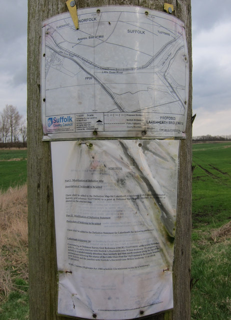
Image: © Hugh Venables Taken: 10 Mar 2012
When rights of way were formalised they were done county by county. Different counties had different levels of enthusiasm, with several paths stopping at the Suffolk border. This path had a gap in it as it dipped into Suffolk but this has now been filled.
Images are licensed for reuse under creativecommons.org/licenses/by-sa/2.0
Image Location
Latitude
52.445289
Longitude
0.450606