Fallen Tree on Trans Pennine Trail
Introduction
The photograph on this page of Fallen Tree on Trans Pennine Trail by Gerald England as part of the Geograph project.
The Geograph project started in 2005 with the aim of publishing, organising and preserving representative images for every square kilometre of Great Britain, Ireland and the Isle of Man.

There are currently over 7.5m images from over 14,400 individuals and you can help contribute to the project by visiting https://www.geograph.org.uk
Fallen Tree on Trans Pennine Trail
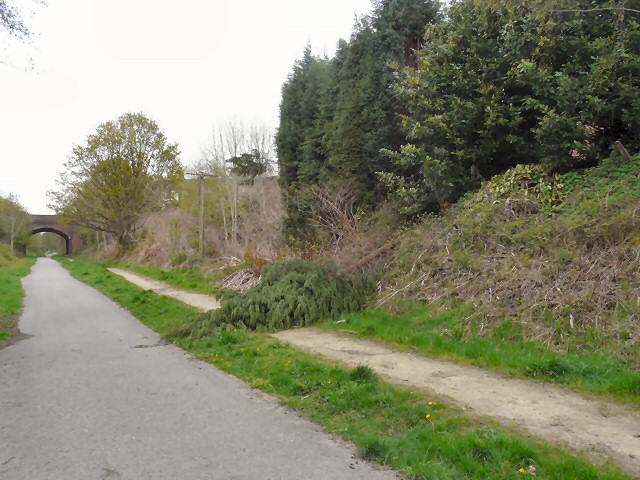
Image: © Gerald England Taken: 3 May 2012
A tree has fallen (or been deliberately toppled) down the embankment of the former Godley Junction to Apethorn Railway line. The line is now part of the Trans Pennine Trail with separate tracks for walkers/cyclists and horse-riders. The tree is blocking the bridlepath. In the background is the Dowson Road bridge.
Images are licensed for reuse under creativecommons.org/licenses/by-sa/2.0
Image Location
Latitude
53.443285
Longitude
-2.077796