The Dead River, West Molesey
Introduction
The photograph on this page of The Dead River, West Molesey by Stefan Czapski as part of the Geograph project.
The Geograph project started in 2005 with the aim of publishing, organising and preserving representative images for every square kilometre of Great Britain, Ireland and the Isle of Man.

There are currently over 7.5m images from over 14,400 individuals and you can help contribute to the project by visiting https://www.geograph.org.uk
The Dead River, West Molesey
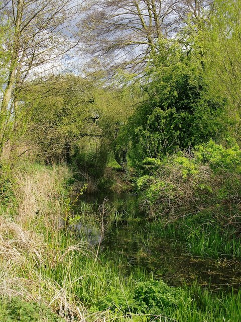
Image: © Stefan Czapski Taken: 30 Apr 2012
Looking at the water in this narrow channel I saw no evidence of flow, in either direction - so I assume that's why the map labels it the Dead River. It can certainly be described as a tributary of the Mole, as it joins that river a couple of hundred yards further east; but it may also be a distributary of the Mole - tracing its origins 'upstream' is not simple. Just out of shot to the left are the back-gardens of houses in Island Farm Road, and allotments. The public open space to the right of the 'river' is Molesey Heath - a local nature reserve.
Images are licensed for reuse under creativecommons.org/licenses/by-sa/2.0
Image Location


Leaflet Map data © OpenStreetMap
Latitude
51.395845
Longitude
-0.371538