Relict farmland hedge-line, Highfield Moss
Introduction
The photograph on this page of Relict farmland hedge-line, Highfield Moss by John Boothby as part of the Geograph project.
The Geograph project started in 2005 with the aim of publishing, organising and preserving representative images for every square kilometre of Great Britain, Ireland and the Isle of Man.

There are currently over 7.5m images from over 14,400 individuals and you can help contribute to the project by visiting https://www.geograph.org.uk
Relict farmland hedge-line, Highfield Moss
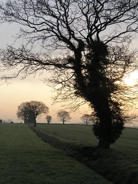
Image: © John Boothby Taken: 19 Apr 2012
Much of Highfield Moss has been reclaimed for farming over the last 150 years, often originally divided-up into quite small fields. Here is an ivy-covered tree taken around dawn, showing clearly its position on a dyke boundary line. Several other lone trees are shown along similar boundaries.
Images are licensed for reuse under creativecommons.org/licenses/by-sa/2.0
Image Location
Latitude
53.459037
Longitude
-2.58668